 Polish Polar DataBase
snow cover, Landsat, Maximum Likelihood, supervised classification
Type of resources
Available actions
Topics
Keywords
Contact for the resource
Provided by
Representation types
Update frequencies
status
-
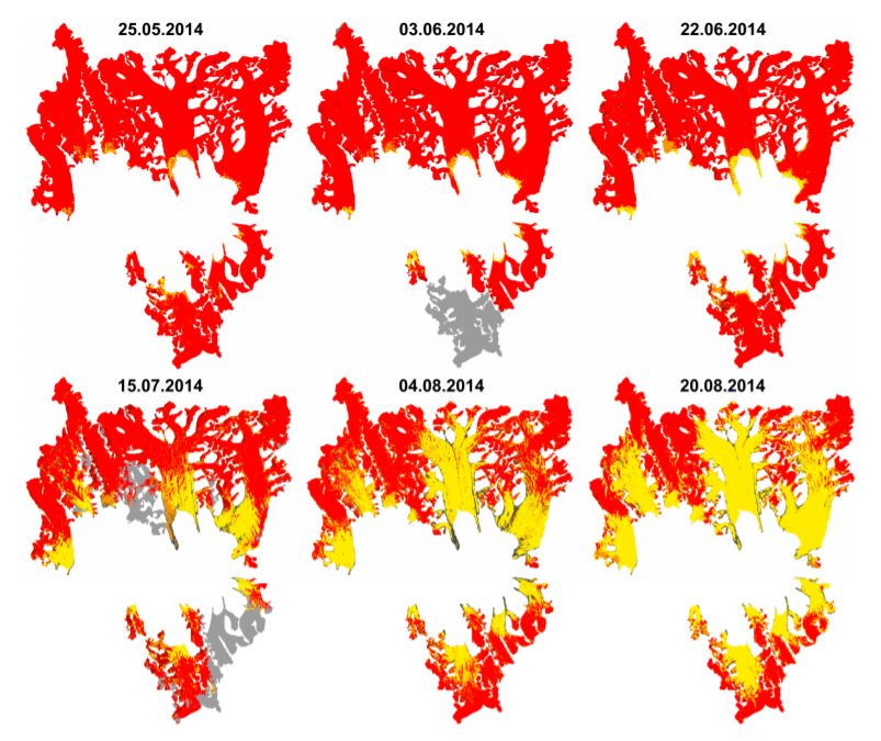
Results of supervised classification of six Landsat 8 images acquired on: 25 May, 3 June, 22 June, 15 July, 4 August and 20 August 2014, covering glaciers in Hornsund fiord. Method of classification: Maximum Likelihood. The results show variability of snow cover areas in melting period of 2014 for glaciers located in Hornsund fiord and larger than 9 km2 (Körberbreen, Samarinbreen, Chomjakovbreen, Mendelejevbreen, Svalisbreen, Hornbreen, Storbreen, Kvalfangarbreen, Mühlbacherbreen, Paierlbreen and Hansbreen). For more information, please check: https://doi.org/10.3390/w9100804 Overview: Results of Maximum Likelihood classification of Landsat 8 images for analysed glaciers. Red - snow cover, yellow - glacier ice, black - debirs, grey - cloud cover.